Steve Kueker knew something was going to happen to the Bois Brule Levee eventually.
“There’ just so much that took place before the break,” Kueker said. “You just had a feeling something bad was going to happen because you’re dealing with the river afterall. It seemed like every 10 or so years, weather patterns would come in and do something. There was a lot of stuff that happened that night. We were really fortunate it happened down the river.”
Kueker turned out to be right.
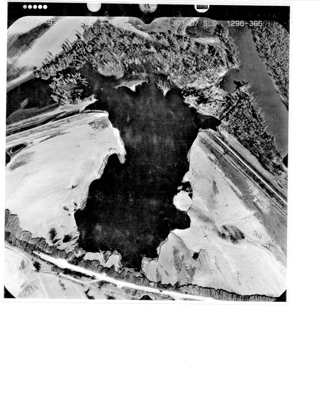
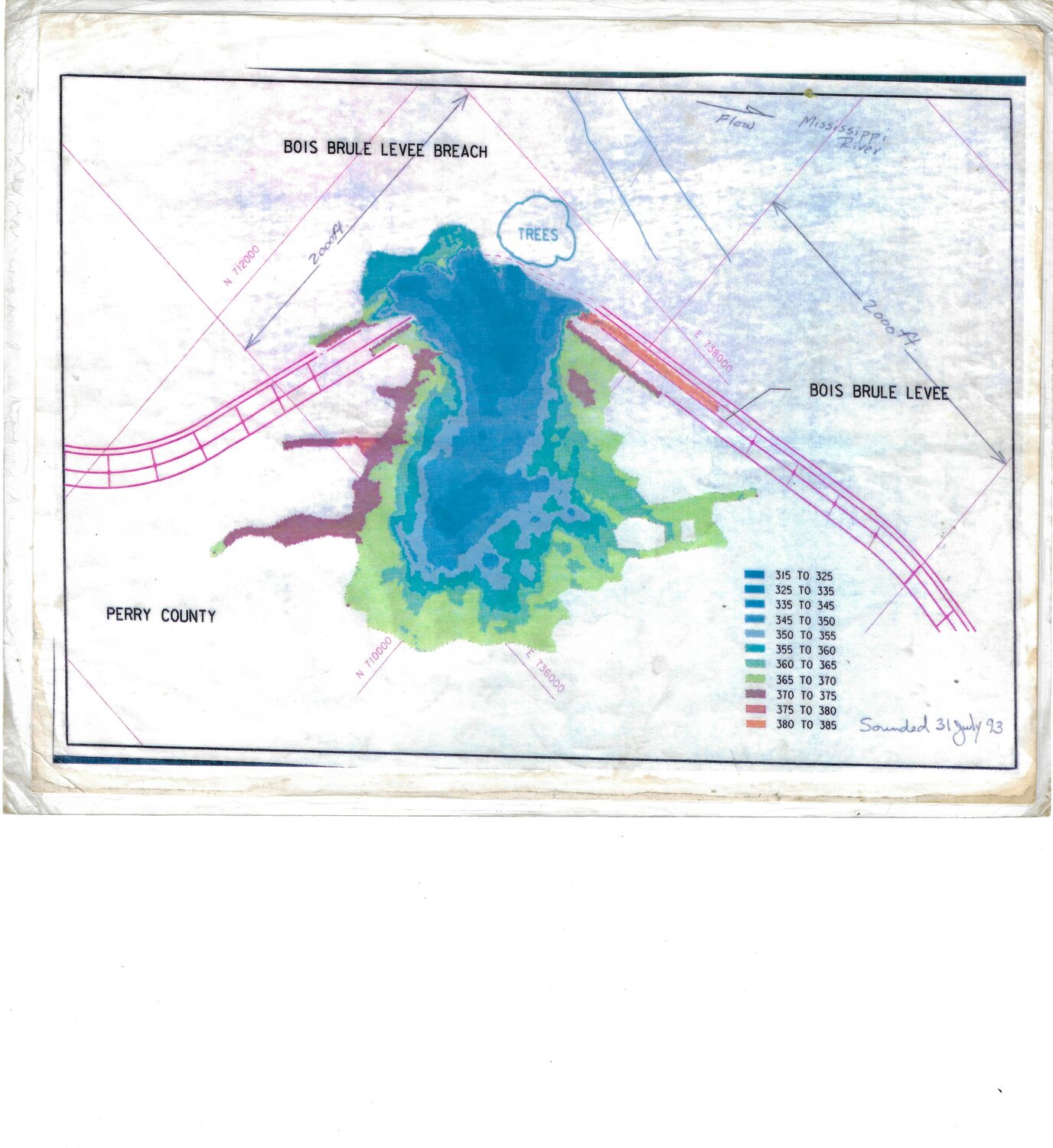
After days of flood warnings, statements, evacuations and preparations, the Mississippi River had finally become too much for the 50-foot Bois Brule Levee to hold back. Monday, July 25, marks the 30th anniversary of the catastrophic breach that resulted in at least 26,000 acres of flooded farmland, an estimated $13 million loss in sorghum, wheat, soybeans, and corn, and at least 90 flooded homes and businesses, including the Sabreliner Corporation at Perryville Regional Airport and Gilster Mary-Lee’s popcorn and cereal plant in McBride, Mo.
Kueker, who was part of the levee district during the disaster said the event could have been much worse.
“The Mississippi River is like a soup bowl with pipes that drain out the bottom of the bowl,” he said. “People don’t realize is that the bottom is not flat here. It actually has a tilt to allow it to flow. At the Chester Bridge, the water is one height and down by Menfro it’s like 10 feet lower. If it had broken at the Chester Bridge it would have decimated more acres and tore up a bunch of stuff.”
The rise in river levels were the result of higher-than-usual wet falls in the previous year, according to a report from the National Weather Service. Some areas had received more than 4 feet of rain during the period leading up to the flood, which resulted in “above normal soil moisture and reservoir levels in the Missouri and Upper Mississippi River basins”. A July 27, 1993 article in The New York Times noted that rocky river bottoms in the Perry County and Cape Girardeau regions contributed to the river’s restricted movement, in contrast with the sandy and muddier river bottoms found below Cairo, Ill. It was a recipe for disaster, and disaster struck quickly.